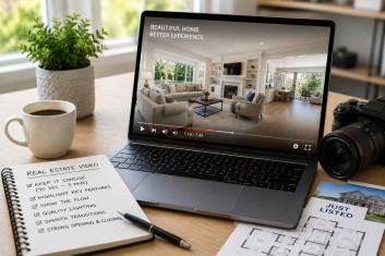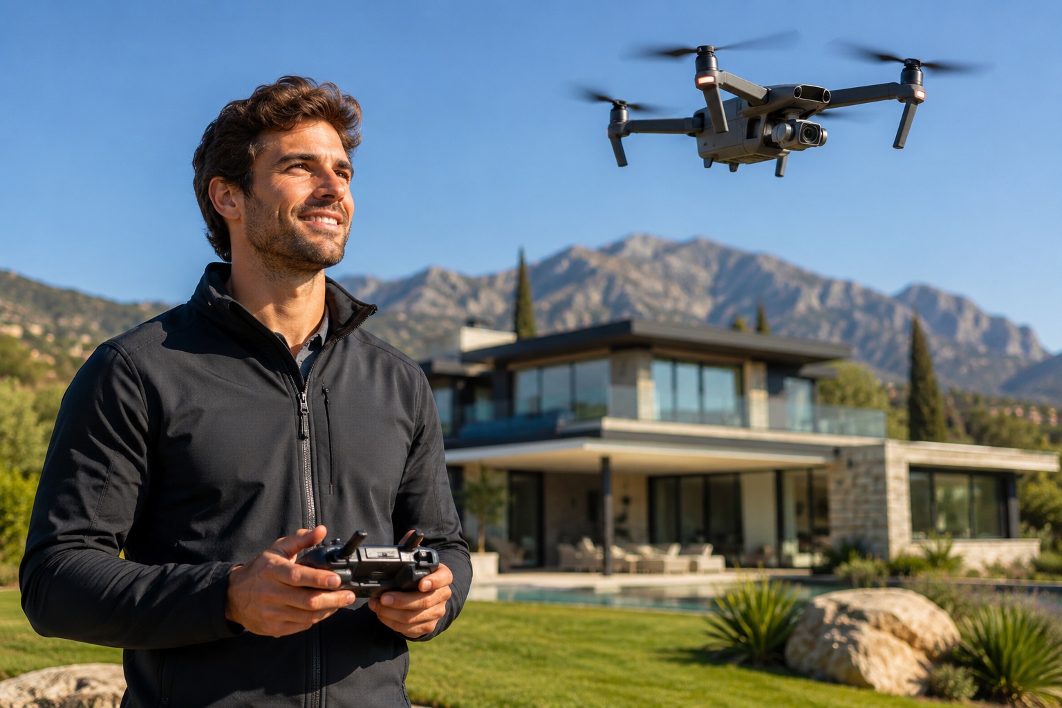
Drone photography has become an increasingly popular marketing tool in the real estate industry, giving buyers a perspective that traditional photography simply cannot provide. While professional interior and exterior photographs remain essential for every listing, aerial photography adds another dimension by showcasing the property’s surroundings, lot size, layout, and unique outdoor features.
However, not every property requires drone photography. Understanding when aerial imagery provides genuine value helps real estate agents, brokers, property managers, homeowners, investors, and developers make informed marketing decisions while maximizing the impact of every listing. In this guide, we’ll explore the situations where drone photography makes the biggest difference and when it may not be necessary.
Why Drone Photography Has Become a Valuable Marketing Tool
Today’s buyers begin their property search online, often comparing dozens of listings before deciding which homes deserve an in-person visit.
Because first impressions are created digitally, visual marketing plays a critical role in attracting buyer attention.
Professional drone real estate photography allows buyers to see a property from an entirely different perspective.
Instead of viewing only individual rooms and the front elevation, buyers gain a better understanding of the home’s relationship to the surrounding landscape, neighboring properties, outdoor amenities, and overall location.
This broader perspective creates a more complete picture of the property while helping buyers appreciate features that may not be visible from ground level.
As discussed in Benefits of Drone Photography for Real Estate Properties, aerial photography enhances property marketing by providing buyers with valuable visual context while helping listings stand out in competitive markets.
Properties That Benefit Most from Drone Photography
Although drone photography can enhance many listings, certain property types benefit significantly more than others.
Large residential properties are among the strongest candidates.
Aerial photography allows buyers to appreciate:
- Large lots
- Extensive landscaping
- Swimming pools
- Outdoor entertainment areas
- Detached garages
- Guest houses
- Long driveways
- Private entrances
Luxury homes also benefit tremendously from aerial imagery.
Many luxury properties feature architectural details and outdoor amenities that cannot be fully appreciated from street level.
Drone photography showcases these features while communicating the lifestyle associated with the property.
Commercial real estate also benefits because aerial imagery helps buyers and investors understand parking availability, building orientation, neighboring businesses, road access, and surrounding infrastructure.
Vacant land is another excellent candidate.
Without aerial imagery, buyers often struggle to visualize property boundaries, topography, and nearby amenities.
Drone photography provides valuable context that helps investors and developers better understand the property’s potential.
Waterfront homes, golf course communities, mountain properties, farms, ranches, vineyards, and equestrian estates are also ideal candidates because location and surrounding scenery contribute significantly to their value.
Our article How Drone Photography Helps Sell Luxury Properties explains in greater detail why aerial imagery has become an essential marketing tool for premium real estate listings.
When Standard Photography Is Enough
While drone photography offers many advantages, it is not necessary for every listing.
Smaller condominiums, apartments, townhomes, and urban residences often gain limited additional value from aerial imagery.
When buyers are primarily interested in interior finishes and room layouts, professional ground-level photography usually provides sufficient information.
Similarly, homes located in densely populated neighborhoods with limited outdoor space may not benefit significantly from aerial perspectives.
In these situations, investing in exceptional interior and exterior photography often delivers a better return.
That does not mean drone photography should never be considered.
Rather, agents should evaluate whether aerial images provide meaningful information that buyers cannot easily understand through traditional photography alone.
If the answer is yes, drone photography may be a worthwhile investment.
Factors to Consider Before Scheduling a Drone Shoot
Before arranging a drone photography session, agents should evaluate several practical considerations.
The property’s size is often the first factor.
Larger lots naturally provide more opportunities for compelling aerial compositions.
Location is equally important.
Properties situated near lakes, beaches, parks, golf courses, rivers, mountains, downtown skylines, or other attractive landmarks often benefit because buyers gain valuable context about the surrounding area.
Weather also plays an important role.
Strong winds, rain, or poor visibility can significantly reduce image quality.
Professional drone photographers carefully monitor weather conditions and schedule flights when lighting and visibility are most favorable.
Legal considerations must also be respected.
Professional drone operators understand local aviation regulations, restricted airspace, and licensing requirements, helping ensure every flight is conducted safely and legally.
Working with an experienced professional helps avoid unnecessary complications while producing higher-quality aerial imagery.
Combining Drone Photography with Traditional Photography
Drone photography should complement traditional photography rather than replace it.
Interior photographs remain essential because buyers still want to see kitchens, living rooms, bedrooms, bathrooms, and architectural details.
Aerial photography simply expands the story.
Instead of asking buyers to imagine how the property sits on the lot, drone imagery provides that answer immediately.
Professional ground-level photography creates emotional connections.
Drone photography provides context.
Together, they create a comprehensive marketing package that gives buyers a much clearer understanding of the property before scheduling a showing.
As explained in Traditional Photography vs Drone Photography, both photography styles serve different purposes and work together to create stronger real estate listings.
Helping Buyers Understand the Complete Property
One of the greatest strengths of drone photography is its ability to answer questions buyers naturally have before scheduling a showing.
Traditional photography focuses on individual spaces inside and outside the home.
Drone photography connects those individual images into a much larger story.
From an aerial perspective, buyers can better understand:
- The property’s position within the neighborhood.
- The relationship between the home and nearby amenities.
- Outdoor living spaces.
- Landscaping.
- Driveway access.
- Property boundaries where appropriate.
- Privacy from neighboring homes.
- Views surrounding the property.
This additional context reduces uncertainty and helps buyers evaluate whether a property fits their needs before they ever visit in person.
Professional aerial images are particularly valuable for relocation buyers and investors who may not have an opportunity to visit immediately.
Rather than relying solely on written descriptions, buyers gain a realistic understanding of the property’s setting through carefully planned aerial photography.
Understanding what buyers expect from aerial imagery is equally important.
Effective drone photographs should provide meaningful information rather than simply dramatic views from high altitudes.
Our article What Buyers Look for in Aerial Property Photos explains which aerial perspectives help buyers make informed purchasing decisions and why thoughtful image selection matters.
Local Expertise Maximizes the Value of Drone Photography
Capturing professional aerial images requires far more than simply flying a drone.
Experienced real estate photographers understand how to highlight each property’s strongest features while considering lighting, composition, neighborhood characteristics, and buyer expectations.
Different markets emphasize different selling points.
Urban buyers may value proximity to downtown, public transportation, and nearby amenities.
Suburban buyers often focus on lot size, neighborhood layout, parks, schools, and outdoor living spaces.
Luxury buyers may place greater importance on privacy, views, landscaping, and architectural scale.
Working with experienced local professionals ensures that aerial photography supports the property’s marketing strategy rather than simply providing attractive images.
Professional planning allows every photograph to communicate valuable information while helping buyers better understand what makes the property unique.
If you’re marketing homes throughout Illinois, combining professional aerial imagery with our Chicago real estate photography services creates a comprehensive visual marketing package that showcases every property from both ground level and above.
Why Drone Photography Continues to Grow in Popularity
Buyer expectations continue to evolve.
As more listings incorporate professional photography, video tours, floor plans, and aerial imagery, buyers increasingly expect complete visual presentations before scheduling a showing.
Drone photography helps satisfy that expectation by presenting information that traditional photography alone cannot provide.
Properties featuring well-executed aerial photography often appear more professionally marketed because buyers receive a better understanding of the property’s location, outdoor features, and surrounding environment.
For agents, this creates an opportunity to differentiate their listings while providing additional value to sellers.
Rather than viewing drone photography as an added expense, many professionals now consider it an investment in creating a stronger online presentation that attracts more qualified buyers.
Conclusion
Drone photography is worth using whenever aerial perspectives provide buyers with valuable information that cannot be effectively communicated through traditional photography alone.
Properties with large lots, luxury features, waterfront locations, acreage, commercial buildings, new developments, and exceptional outdoor amenities often benefit the most from professional aerial imagery.
When combined with professional ground-level photography, drone real estate photography creates a complete visual marketing package that helps buyers better understand a property’s layout, surroundings, and overall appeal.
By choosing drone photography strategically rather than automatically, real estate professionals can create more informative listings, strengthen buyer confidence, and present every property in the most compelling way possible.